Piegan Pass
| Trail Features: | Outstanding views | 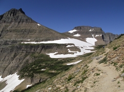 |
|||
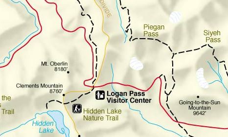
| Trail Location: | Siyeh Bend | ||||
| Roundtrip Length: | 9.2 Miles | ||||
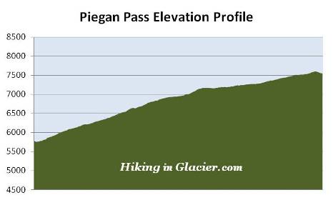
| Total Elevation Gain: | 1850 Feet | ||||
| Avg. Elev Gain / Mile: | 402 Feet | ||||
| Highest Elevation: | 7600 Feet | ||||
| Trail Difficulty Rating: | 12.90 (strenuous) | ||||
| Parking Lot Latitude | 48.70145 | ||||
| Parking Lot Longitude | -113.66959 | ||||
Trail Description:
The hike to Piegan Pass in Glacier National Park begins from the Siyeh Bend Trailhead, located 2.2 miles east of Logan Pass on the Going-to-the-Sun Road. Hikers also have the option of using the Piegan Pass Trailhead from the Jackson Glacier Overlook, but this would add a little more distance to your hike, and several hundred more feet of climbing. The Siyeh Bend Trail offers hikers a much more gradual climb to their destination.
From the Going-To-The-Sun Road, the Siyeh Bend Trail travels alongside Siyeh Creek for roughly two hundred yards before making a sharp right turn into the forest. At roughly 1.1 miles from the trailhead hikers will arrive at the Piegan Pass Trail junction. A turn to the right leads down to the Jackson Glacier Overlook. To continue towards Piegan Pass hikers should turn left here.
The lower elevations of the hike pass through a dense spruce-fir forest. The forest, however, begins to thin out as you approach the Siyeh Pass Trail junction, located almost 2.7 miles from the trailhead. To continue towards Piegan Pass hikers should proceed to the left at this junction. A turn to the right would lead you to Preston Park, and eventually up to Siyeh Pass.
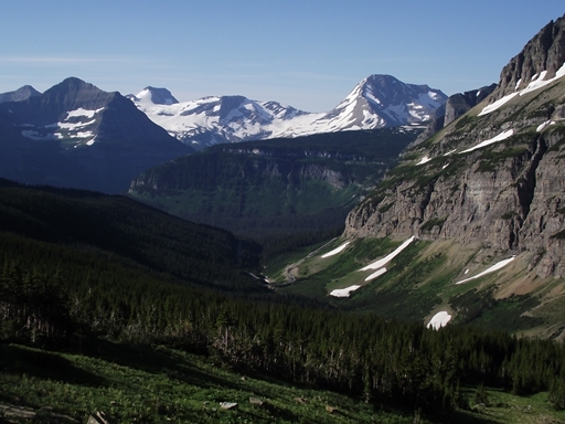
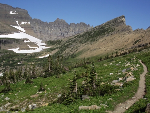
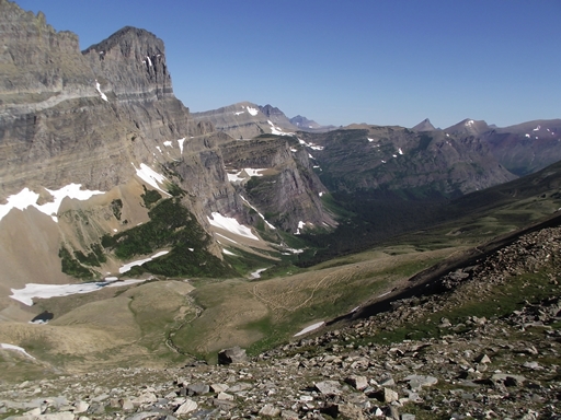
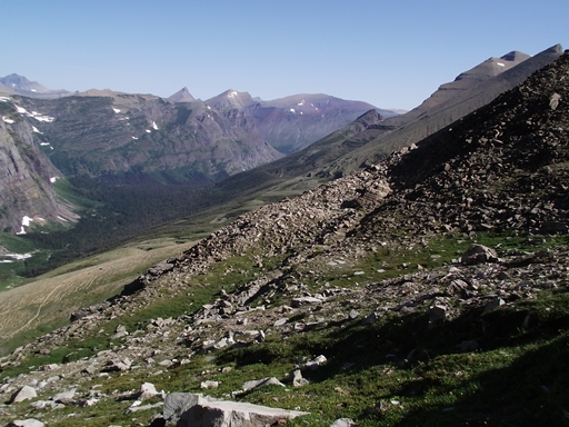
At roughly 3 miles the Piegan Pass Trail finally emerges above the treeline and onto the talus-scree slopes of 10,014-foot Mount Siyeh. Looking towards the south - across the valley - you'll have some absolutely grand views of Jackson Glacier, and Blackfoot Glacier, the largest glacier in the park. Almost directly west of you is Piegan Glacier, which sits just below the summit of 9220-foot Piegan Mountain (see photo below). Your destination also comes into view. Simply follow the trail line as it makes its gradual ascent all the way up to the pass.
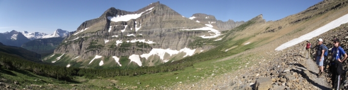
At roughly 4.5 miles from the trailhead you'll reach the top of Piegan Pass, which is the saddle between Piegan Mountain and Cataract Mountain. For perhaps the best views along the entire route, continue hiking for another tenth-of-a-mile or so. By walking only a short distance from the top of the pass hikers will find outstanding views of Angel Wing, Bishops Cap and Mount Gould along the Garden Wall, as well as views deep into the Many Glacier Valley. The entire Piegan Pass area offers spectacular views and scenery, easily making this one of the best hikes in Glacier National Park.
Hikers should also keep an eye out for ptarmigan and mountain goats, both of which are known to frequent the area around the pass.
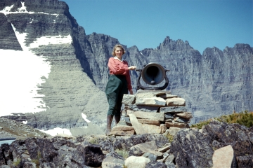 Piegan Pass has the distinction of being one of four sites in Glacier to have had a locomotive bell installed on it. In 1925, W. R. Mills, an advertising agent with the Great Northern Railway, and H. A. Noble, manager of the Glacier Park Hotel Company, requested permission from the park to place locomotive bells on the summits of several passes in Glacier. According to Donald H. Robinson's Administrative History of Glacier National Park, the request was based on the old Swiss custom of placing bells on mountain tops and passes to allow hikers or horseback riders the unusual experience of ringing loud bells high in the mountains, as well as to let people in the valleys know that they had reached their destination. In September of 1926 the request was finally granted to place bells at Swiftcurrent Pass, Piegan Pass and Siyeh Pass. Three years later a fourth bell was added at Scenic Point in Two Medicine. The bells remained in place until the fall of 1943, when they were removed by the hotel company and donated to a World War II scrap metal drive.
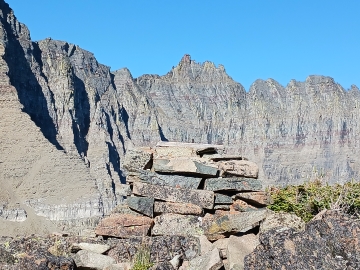 Today, the stone platform that supported the bell still stands atop Piegan Pass. Just as you reach the eastern side of the saddle, look towards the right to see the platform standing several feet above the trail. Additionally, a little further towards the summit of the pass, you may also notice a pile of rocks that looks a little out of place. If you look a little closer you may notice several scraps of metal and a foundation. This appears to be the ruins of some type of hut, though I haven't found any information that pinpoints to exactly what this was used for.
Ramble On: A History of Hiking discusses the fascinating story of why Glacier came to be associated with Swiss culture, and how it impacted the development of its extensive trail system during the early years of the park.