Granite Park Chalet (via Highline Trail)
| Trail Features: | Outstanding views, Meadows, Wildflowers | 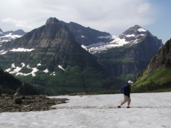 |
|||
| Trail Location: | Logan Pass | ||||
| Roundtrip Length: | 15.2 Miles | ||||
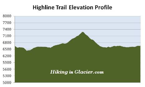
| Total Elevation Gain: | 1920 Feet | ||||
| Avg. Elev Gain / Mile: | 253 Feet | ||||
| Highest Elevation: | 7280 Feet | ||||
| Trail Difficulty Rating: | 19.04 (strenuous) | ||||
| Parking Lot Latitude | 48.69657 | ||||
| Parking Lot Longitude | -113.71813 | ||||
Trail Description:
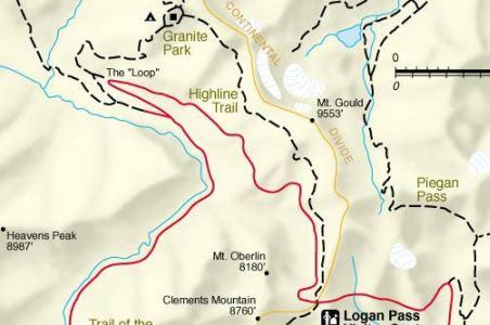
This hike to the Granite Park Chalet in Glacier National Park begins from the Highline Trailhead, located on the north side of the Going-to-the-Sun Road at Logan Pass. To avoid the frequently full parking lot at Logan Pass, you may want to consider taking the free shuttle up to the pass.
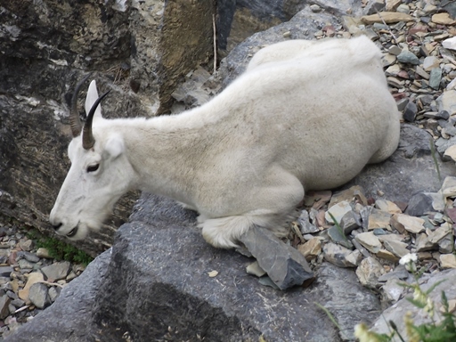
The Highline Trail is an extremely popular hike; and for good reason. At every step, and every turn, hikers will enjoy spectacular scenery as they traverse along the Continental Divide, also known as the Garden Wall throughout this section of Glacier National Park. The exceptionally beautiful views, the excellent opportunities for spotting wildlife, and the wildflowers, all combine to make this a hike you'll remember the rest of your life.
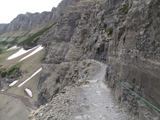
At roughly one-quarter of a mile from the trailhead hikers will arrive at the famous ledge with the reputation for terrifying those with a fear of heights. In most places the ledge, hanging like a shelf along the Garden Wall, is only six to eight feet in width, and has sheer drop-offs of roughly one hundred feet or more down to the Going-to-the-Sun Road below. This segment lasts for only three-tenths of a mile, but may seem forever if you have a fear of heights. Fortunately Glacier National Park has installed a hand cable along this stretch of the trail. My advice is to not let this deter you, as this is one of the most scenic hiking trails in America.
From the rimrock area the trail continues to hug the cliffs and slopes of the Garden Wall, and does so for most of its length to Granite Park. Throughout the early portions of the hike Mount Cannon, Mount Oberlin and Heavens Peak will dominate the views towards the west.
Roughly 2.5 miles from Logan Pass the slopes of the Garden Wall begin to moderate. Soon you'll begin the only major climb of the day, a short section of trail that leads hikers up to Haystack Pass.
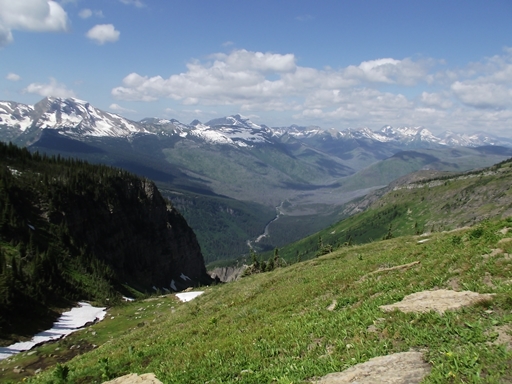
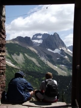
At 3.6 miles, after climbing roughly 275 feet along one long switchback, hikers will reach Haystack Pass. At an elevation of 7024 feet, the pass forms the saddle between 7486-foot Haystack Butte and the Garden Wall, which at this point is technically the southeastern flank of Mt. Gould. With its outstanding panoramic views, Haystack Pass is also a popular spot for an extended snack break.
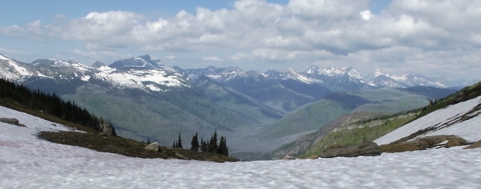
Beyond the pass the trail continues to ascend along the Garden Wall. Soon you'll reach the highest point on the hike. After topping out at an elevation of roughly 7280 feet the trail begins descending towards Granite Park. As you proceed, 8436-foot Swiftcurrent Mountain will eventually come into view looking towards the north.
At 6.9 miles hikers will reach the Garden Wall Trail. This optional side trail climbs roughly 900 feet - in less than nine-tenths of a mile - to the top of the Continental Divide, and provides hikers with a commanding birds-eye view of The Salamander and Grinnell Glacier on the opposite side.
 At 7.6 miles hikers will arrive at the Granite Park Trail junction. Towards the right the Highline Trail continues towards the Fifty Mountain Backcountry Campground, located roughly 12 miles away. It also leads to the Swiftcurrent Pass Trail, located roughly two-tenths of a mile away. A turn to the left will lead you down towards The Loop on the Going-to-the-Sun Road. To visit the Granite Park Chalet, hikers should proceed straight ahead at this junction.
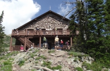
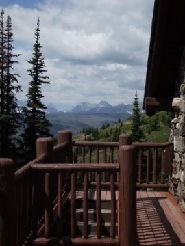
The Granite Park Chalet was built by the Great Northern Railway in 1914 and 1915 to provide comfortable backcountry accommodations inside Glacier National Park. The rustic lodge was the last of the nine chalets built by the railroad, and today is listed as a National Historic Landmark. For a more in-depth history of Glacier's historic hotels and backcountry chalet system, I highly recommend View with a Room.
Compared to Sperry Chalet, the Granite Park Chalet is much more basic, and is essentially a simple hiker's hostel, with virtually no amenities. It has 12 guest rooms, each with 2 to 6 bunks. Although there's no electricity, the common-area kitchen does have a propane stove that can be used to cook a warm lunch or dinner. The chalet sells packaged foods, beverages, snacks, and bottled water to day hikers. If not interested in buying water, there's a stream about a quarter-mile away along a rocky and rugged trail. You'll have to treat this water first. For more information and to make a reservation, please click here.
Please note that the elevation information above assumes an out and back hike. If you're only hiking to the chalet the elevation gain would only be 975 feet. If you wish to sleep under the stars the Granite Park backcountry campground is nearby. It contains four individual sites, two of which can be reserved ahead of time.