

| The Continental Divide Trail in Glacier National Park |
The Continental Divide National Scenic Trail travels roughly 3,100 miles along the Continental Divide of the Rocky Mountains between Mexico and Canada. Along the way it traverses through five states;
 New Mexico, Colorado, Wyoming, Idaho and Montana. It also passes through numerous National Forests, Wilderness Areas, BLM lands, state lands, as well as three national
parks; Rocky Mountain, Yellowstone and Glacier.
New Mexico, Colorado, Wyoming, Idaho and Montana. It also passes through numerous National Forests, Wilderness Areas, BLM lands, state lands, as well as three national
parks; Rocky Mountain, Yellowstone and Glacier.
The trail was designated by Congress as a National Scenic Trail in 1978. As of 2016, roughly 71% of the trail has been marked and routed by the Continental Divide Trail Association. The remainder of the trail is currently located on dirt and paved roads. Ultimately the CDTA would prefer to relocate these sections to suitable wilderness paths as opportunities arise.
Roughly half of the estimated 980 miles of CDT in Montana and Idaho still needs to be permanently routed. However, in Glacier, the trail system is already in place. Roughly 110 miles of the Continental Divide Trail runs within the boundaries of Glacier National Park.
The CDT enters Glacier from the south on US Highway 2 at Marias Pass near the Summit Campground. After passing Three Bears Lake just a half mile from the trailhead, the CDT hooks up with the Autumn Creek Trail and follows its northeasterly direction into East Glacier Park, where it steps out of the park boundary for a brief section.
From the small hamlet of East Glacier Park, hikers take the Mt. Henry Trail back into the park, up to Scenic Point for some commanding views of Two Medicine Lake, and then back down to Two Medicine. From here the CDT traces the Pitamakan Pass Trail all the way to Atlantic Creek. During this section, hikers will encounter some amazing scenery while visiting destinations such as Old Man Lake, Pitamakan Pass, Pitamakan Lake and Morning Star Lake.
Beyond Atlantic Creek hikers will travel up
the slopes of Triple
Divide Peak, which serves to separate rain and snow from flowing into
the
Hudson Bay, Atlantic Ocean or the Pacific Ocean drainages. From the
pass hikers will follow Hudson Bay Creek, past Red Eagle Lake, and onto the
junction with
the St. Mary Lake Trail. Hikers now begin heading westward as they
follow along
the southern shore of St. Mary Lake until reaching Virginia
Falls. After
passing St. Mary Falls, the CDT then  hooks up with the Piegan Pass
Trail, which
thru-hikers will follow all the way into Many Glacier. This is another
spectacular section of trail that takes hikers over Piegan
Pass, while offering
commanding views of Jackson Glacier, Blackfoot Glacier and the Garden
Wall for
several miles.
hooks up with the Piegan Pass
Trail, which
thru-hikers will follow all the way into Many Glacier. This is another
spectacular section of trail that takes hikers over Piegan
Pass, while offering
commanding views of Jackson Glacier, Blackfoot Glacier and the Garden
Wall for
several miles.
From Many Glacier, trekkers will hike up to the spectacular Swiftcurrent Pass where they will have the option of staying overnight at the Granite Park Chalet (reservations required). From here the CDT follows the Highline Trail all the way to Fifty Mountain. This section of trail traverses through some of the most remote country Glacier has to offer, and passes below a series of glaciers on the ridgelines and mountains rising above you. At Fifty Mountain the trail changes its name to the Waterton Valley Trail. From here, through-hikers will follow, for the most part, the Waterton River into Goat Haunt on the southern shores of Waterton Lake.
To complete the CDT, follow the Waterton Lake Trail to the Canadian border where the trail technically ends. From here you can either return to Goat Haunt, or continue onto the Waterton Townsite. If you decide to proceed into Canada, you will need to check in at the ranger station in Goat Haunt for proper border crossing approvals beforehand.
You should also note that there are alternate routes for early season hikers who wish to avoid snow obstacles during the spring and early summer seasons. Both routes are clearly marked on the National Geographic Trail Illustrated Sectional Maps.
Other Resources:
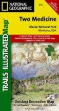
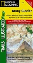
For CDT thru-hikers in Glacier Park, there are two maps that will come in handy. National Geographic has published three Trail Illustrated Sectional Maps. The two needed for a complete thru-hike are the Two Medicine and the Many Glacier sections.
* Glacier
National Park information
* Backcountry camping in Glacier
* The Continental Divide Trail Society
* Montana and Idaho's Continental Divide Trail: The Official Guide