Trail of the Cedars
| Trail Features: | Forest hike, Waterfalls | 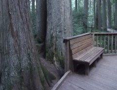 |
|||
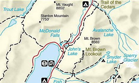
| Trail Location: | Avalanche Creek | ||||
| Roundtrip Length: | 1.0 Mile | ||||
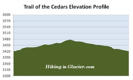
| Total Elevation Gain: | 60 Feet | ||||
| Avg. Elev Gain / Mile: | 120 Feet | ||||
| Highest Elevation: | 3478 Feet | ||||
| Trail Difficulty Rating: | 1.12 (easy) | ||||
| Parking Lot Latitude | 48.6806 | ||||
| Parking Lot Longitude | -113.81923 | ||||
Trail Description:
 The Trail of the Cedars, one of two wheelchair accessible trails in Glacier National Park, is a loop hike that begins and ends along the Going-To-The-Sun Road, located 5.5 miles east of the Lake McDonald Lodge. Since this is an extremely popular trailhead, parking can be an issue during peak travel season.
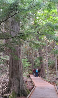
Obviously you can start from either side, but most people begin their hike by proceeding along the eastern portion of the loop. This side of the loop travels along a raised boardwalk, and passes through a forest of ancient western red cedars and western hemlocks.
Being situated on the eastern edge of the maritime climate of the Pacific Northwest, the Lake McDonald Valley also marks the extreme eastern limits for western hemlocks and red cedars. The humidity in this valley allows red cedars to grow to heights of 100 feet, and diameters of 4 to 7 feet. Some of the trees in this area are estimated to be more than 500 years old.
Look closely and you'll also notice the lush green of ferns and mosses growing along the forest floor. The boardwalk along this portion of the loop encourages visitors to take their time as they walk through habitat more normally found on the Pacific Coast.
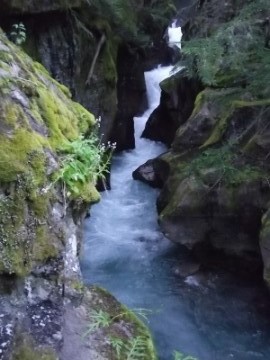 At roughly the half-way point you'll reach one of the highlights of the trail, a footbridge over Avalanche Creek that provides commanding views of the lower Avalanche Gorge.
Just past this point is the Avalanche Lake Trail junction. For those wishing to get a closer view of the gorge you can walk about a tenth-of-a-mile up the Avalanche Lake Trail. Although it's a short, steep climb to reach the banks of Avalanche Creek, you'll enjoy a front row view of the amazing power of glacially melted water as it cascades through the narrow gorge. From this point the trail continues on for another 1.6 miles to reach Avalanche Lake, if you wish to explore more of this area of the park.
As you continue along the loop hike, the trail now proceeds over to the western half of the loop. The pathway along this stretch is paved. From here the route runs past the Avalanche Creek Campground and back out to the road again.
The Avalanche Basin area of Glacier National Park was named by Dr. Lyman Sperry. While exploring the basin in June of 1895, Sperry saw and heard multiple avalanches roaring down the surrounding mountains, and agreed with his exploring party "that Avalanche Basin would be a most appropriate name for the place". On a return trip later that summer Sperry would discover the glacier that now bears his name.