Forest and Fire Nature Trail
| Trail Features: | Scenic views, Wildflowers | 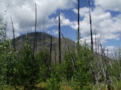 |
|||
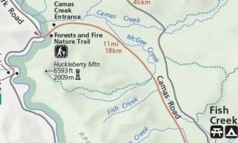
| Trail Location: | Camas Creek Entrance | ||||
| Roundtrip Length: | 1.1 Miles | ||||
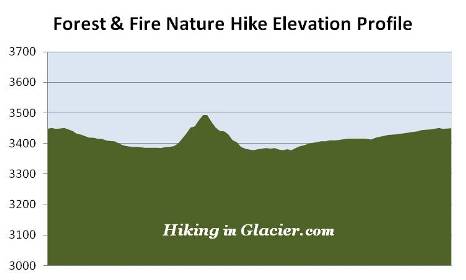
| Total Elevation Gain: | 180 Feet | ||||
| Avg. Elev Gain / Mile: | 327 Feet | ||||
| Highest Elevation: | 3493 Feet | ||||
| Trail Difficulty Rating: | 1.46 (easy) | ||||
| Parking Lot Latitude | 48.62442 | ||||
| Parking Lot Longitude | -114.13004 | ||||
Trail Description:
The Forest and Fire Nature Trail in Glacier National Park is located near the Camas Creek Entrance. To reach the trailhead from the Going-To-The-Sun Road near Apgar, drive 10.9 miles north on Camas Road, and then turn left onto a side road located between the self-serve entrance kiosk and the Glacier Park Entrance Sign. Although the trail is currently named the Forest and Fire Nature Trail, the park road signage still indicates the old name; the Huckleberry Mountain Nature Trail. The side road leading to the trailhead is a very short drive up the hill.
At just over one-tenth of a mile from the trailhead hikers will reach the loop portion of the trail. It's recommended, based on the park's suggestion, that you should turn left here, thus hiking the loop in a clockwise direction.
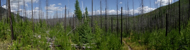
During the early portions of the hike you'll be walking through the rebirth of a brand new forest. There are literally thousands of lodgepole pine saplings growing here now, most of which are two-to-seven feet in height at this point. You'll also see quite a few young aspens growing here as well. As the trail proceeds onward, hikers will also see thousands of dead trees. This area of the park was severely burned in 1967, and then again in 2001 during the Moose Fire.
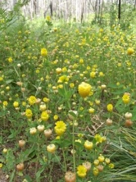
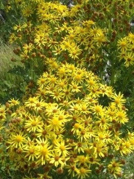
As part of its rebirth a burned forest will attract wildflowers. Hikers will notice a large number of yellow clover carpeting the sides of the trail throughout this hike. Unfortunately most were already past their prime during our mid-August hike. If you were to hike this trail earlier in the summer the sight would be quite a spectacle. A variety of other wildflowers can be seen in this area as well, including fireweed and golden asters.
At roughly the halfway point the trail begins a short climb of a little more than a hundred feet. The vantage point near the top provides some pretty good views of the Flathead River and the mountains towards the north. You'll also have some pretty good views of the mountains near the Continental Divide, albeit through the canopy of dead trees still standing.
The high point of this trail also puts you right in the middle of a nice thimbleberry patch, and if your timing's right, there are some pretty good pickings here. The patch likely attracts bears, so make sure you make a lot of noise throughout this section of the hike.
At just under a mile you will have completed the loop portion of the hike. A turn to the left here will return you back to the trailhead, roughly one-tenth of a mile from this junction.
The Forest and Fire Trail is a very pleasant hike. If you're looking for an easy hike, a degree of solitude from the crowds, and something with expansive views (not necessarily mountainous, but good views nonetheless), this is a good option to consider.